The hiking season will be shorter than usual because of the cooler weather. But it’s no excuse to miss out on the adventurous outdoor activity.
According to Nikolay Fetisov, head of the Like to Hike active tourism agency, Ukraine has around 100 hiking routes. Most of them are in the west, located near or across the Carpathian Mountains.
Fetisov recommends that beginners try several hiking routes with professional guides or with the assistance of travel companies first.
“I would advise the newbies to pick hiking equipment and get physical training before going on long-distance hikes,” Fetisov told the Kyiv Post.
Experienced hikers, who have explored the Carpathians far and wide might enjoy trips across Polesia, a natural and historical region in the north of Ukraine. Fetisov, however, says that “there is always something left to see” in the Carpathians, recommending to check out the offbeat areas in the mountains.
The Kyiv Post has picked out some of the best hiking routes available in Ukraine.
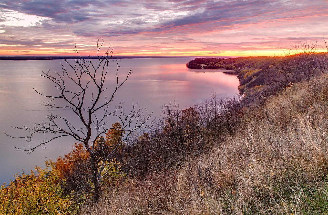
Hiking in Trakhtemyriv Natural Reserve of Cherkasy Oblast offers an opportunity to enjoy panoramic landscapes of the Kaniv Reservoir that open up from Mount Poklonna and Mount Makovyshche. (Moahim)
Trakhtemyriv Natural Reserve
30 kilometers, easy level
Route: Trakhtemyriv village — Mount Poklonna — Mount Makovyshche — Hryhorivka village — Lake Buchak in Buchak village.
About 130 kilometers south of Kyiv, on the peninsula near the banks of the Kaniv Reservoir, there’s a tiny village and an ancient Cossack capital located in Cherkasy Obalst — Trakhtemyriv. Hikers can reach it by car or bus and embark on a spectacular hiking trip around the Trakhtemyriv Natural Reserve. The visitors can enjoy the view of 150-meter-long cliffs on the sides of the Dnipro River. A no less fascinating panoramic landscape of the Kaniv Reservoir opens up from Mount Poklonna or Mount Makovyshche, one of the spiritual locations in the reserve. The destination offers a number of other attractions, including an ancient Scythian settlement, the blue water of Lake Buchak, village Hryhorivka located in a river valley and village Buchak that has several archaeological sites of the early Slavic period.
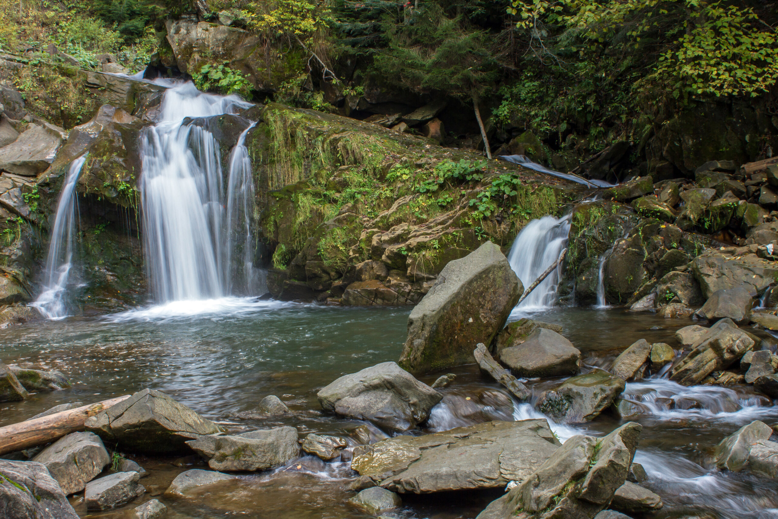
Hurkalo waterfall is one of the natural sights that travelers can spot while hiking across the Podilski Tovtry National Park in western Khmelnytsky Obalst. (Ig0r1982)
Podilski Tovtry National Park
40 kilometers, easy level
Route: Kamianets-Podilskyi city — Bakota village — Bakota cave monastery — Teremtsi former settlement — Kytaihorod village — Kamianets-Podilskyi.
This hiking route has it all: mountains, water and history. On this adventure across Khmelnytsky Oblast, 350 kilometers southwest of Kyiv, travelers will have an opportunity to explore picturesque Bakota Bay, the banks of the Dnister River, the canyon of the Studenytsia River and Mount Teremi. During the hike, tourists can also visit a cave monastery, drink water from springs, see abandoned fruit tree orchards and the Tovtry limestone ridge.
A spectacular view opens up from the peak of Mount Parashka, one of the highest mountains in Lviv Oblast. (Vitalii Demus)
Skolivski Beskydy National Park
20 kilometers, easy level
Route: Truskavets city — Skole town — Mount Parashka — Hurkalo waterfall — Tustan fortress — Truskavets.
On this route in the Carpathians, hikers will explore one of the highest mountains of Lviv Oblast, 1,268-meter-high Mount Parashka. They will walk through the magnificent forestry Skolevski Beskydy National Park and see the Hurkalo waterfall. The travelers will also be able to enjoy the views of rocky mountains and the fortress city of Tustan built on the cliffs — a place to immerse in the atmosphere of the Ukrainian Middle Ages.
Mount Shpytsi
19 kilometers, easy level
Route: Ivano-Frankivsk city — Maryshevska polonyna — Mount Shpytsi — Mount Rebra — Nesamovyte Lake — Ivano-Frankivsk.
A simple but beautiful hiking route in the Carpathians with a climb to the Mount Shpytsi offers stunning views of the entire Chornohora, Ukraine’s highest mountain range. The route lies through the meadows and past the famous Lake Nesamovyte, one of the country’s highest alpine lakes located 1,750 meters above the sea level. Another gem of this route is the natural stone mounds that form corridors at an altitude of 1,800 meters.
The largest lake in the Ukrainian Carpathians, Synevyr is part of a popular hiking route that also covers the Pishkonia mountain range in Zakarpattia. (Antonina Vyshnevska )
Lake Synevyr
25 kilometers, medium level
Route: Volovets settlement — Kolochava village — Mount Barvinok — Mount Horb — Mount Nehrovets — Mount Big Hropa — Mount Small Hropa — Mount Pishkonia — Ozirce Lake — Synevyr Lake — Volovets.
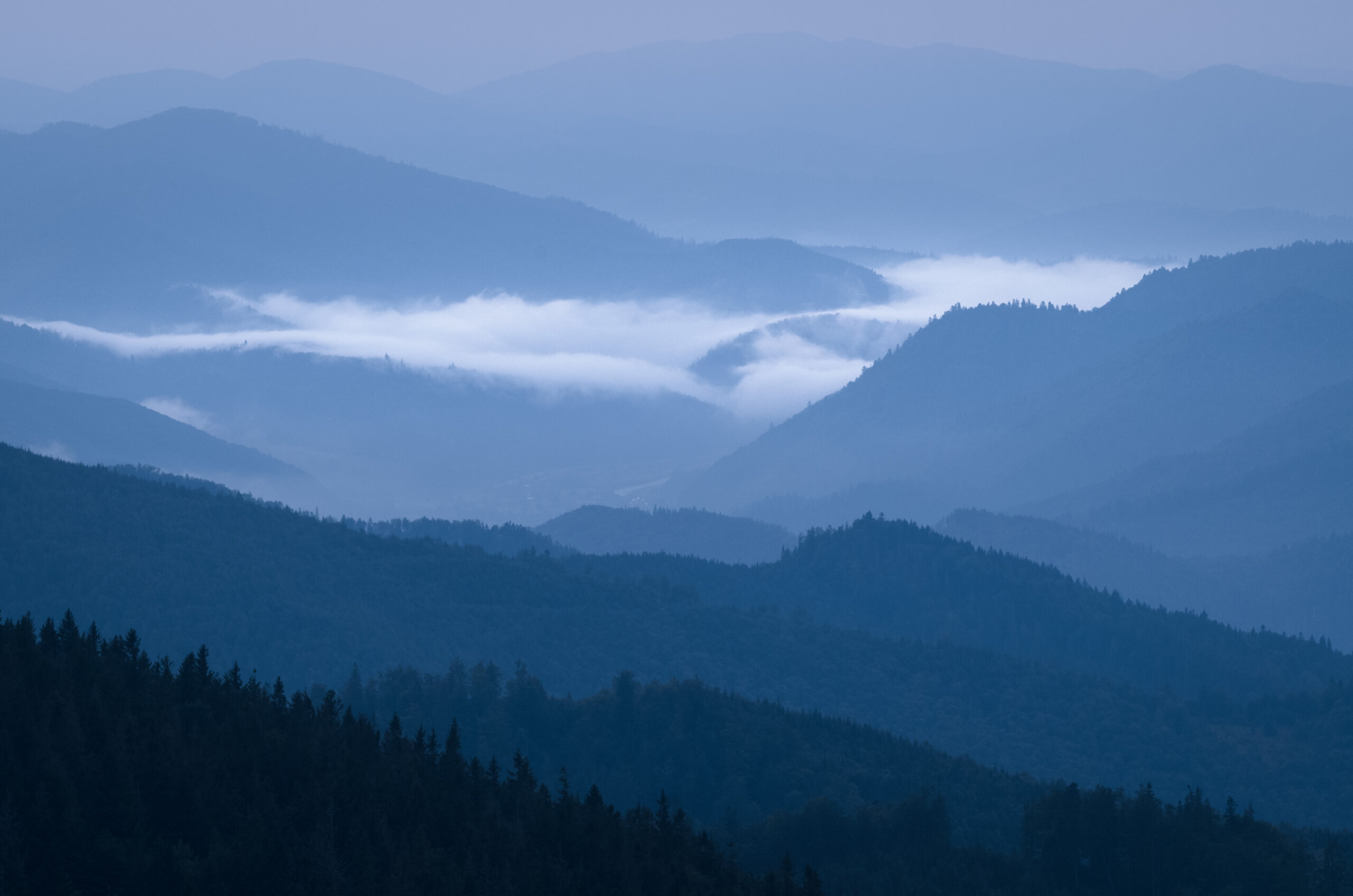
Although this route through the Carpathian Mountains is more difficult than the others, the adventures it promises are well worth the effort. Aside from the picturesque mountain landscapes, during the two-day hike, travelers will discover one of Ukraine’s most famous and beloved destinations, Lake Synevyr. Often referred to as “the heart of the Carpathians,” Synevyr is the largest lake in the Ukrainian Carpathians that lies through the Pishkonia range in Zakarpattia. A marvelous panoramic view of majestic mountains and grassy slopes opens up from this range. Apart from Synevyr, in the mountains, hikers can also spot a wild lake called Ozirce.
Gorgany mountain range
32 kilometers, medium level
Route: Ivano-Frankivsk — Osmoloda village — Rosohan Lake — Arshytsia Lake — Mshana polonyna — Mount Gorgan Ilemskyi — Nimetska polonyna — Mount Velykyi Pustoshak — Myslovka village.
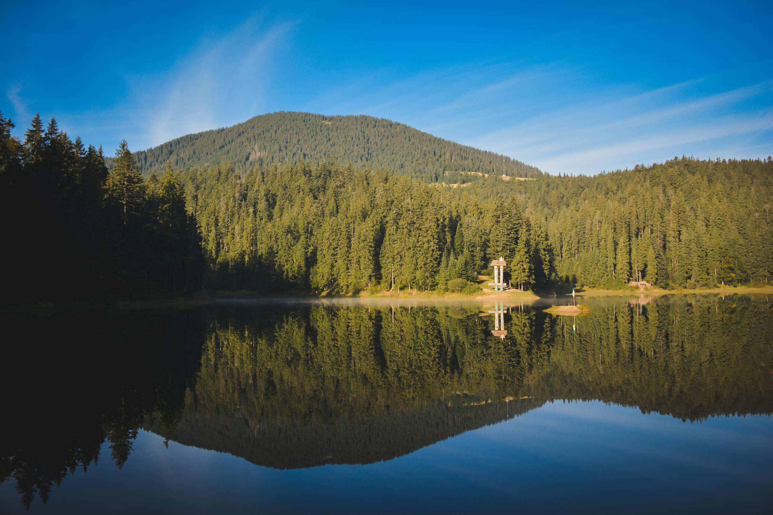
Gorgany is one of the most remote mountain ranges of the Carpathians. The hiking route in that area lies through a century-old spruce forest and past two mountain lakes, Rosohan and Arshytsia, hidden in the depths of the greenery. Tourists can swim in the crystal clear water of both lakes and enjoy the grandeur of the surrounding forest.